K-12 students in Missouri now have access to free geographic information system software that allows users to overlay information onto maps.
From homeschool programs to Boy Scouts to schools, almost any youth organization can apply for the GIS for free online at gis.missouri.org. GIS contains software ranging from 3D maps to applications for personal GPS handheld devices.
According to the website, the project aims to promote geospatial technologies for students in Missouri.
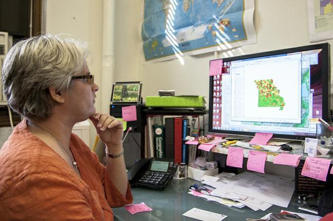
“GIS is not like Google Earth,” Missouri Geographic Alliance coordinator Shannon White said. “What GIS gives to education is the ability to look at more than just a pretty map.”
White said GIS allows users to overlay maps with information in order to answer questions. White said some students might use it to answer questions like comparing population sizes of ethnic groups.
“In a science class, for example, you have this immediate connection with this data and the visual map,” White said. “With Google Earth, you could never ask where is the population of one ethnic group larger than another ethnic group. You could take guesses about it. But that’s not on Google Earth.”
White said the information isn’t just for schools or organizations with huge technology budgets.
“We’re giving the world to children in all regions of Missouri,” White said in a news release. “Schools with limited resources stand to benefit greatly from this program. If Internet access is limited and computers are scarce, the GIS can be used from a single computer, and teachers can use projectors so the whole class can see. If GPS units are unavailable, students can use their smartphones to mark data points. There’s an app for that.”
White spearheaded the project over three years and collaborated with several organizations on the GIS system, including Esri, a leader in the field of GIS. She said she was one of the first people to start fully investigating how to integrate GIS systems in the classroom when she was at North Carolina State University.
Missouri is now the 17th state in the U.S. with a fully functioning GIS system.
“It is pretty user friendly once you get used to it,” White said. “(But) the teacher is going to have some sort of professional help.”
On Saturday, the Missouri Geographic Alliance is hosting a conference to help train people to use the program. So far, 65 people are signed up for the conference. White said the people who are interested in the program are from all over the state, and word of the conference and GIS has spread mainly through word of mouth.
White said the feedback has been pretty positive so far. One of the first schools to use the GIS program was the Columbia Area Career Center, which taught a course in GIS. White said the technology greatly benefitted the students.
“(It was used) for students to be able to go into college and study GIS as part of their college courses,” White said.
White said she couldn’t talk about how much the GIS project cost, but she said $140,000 worth of work and volunteerism is being devoted to spreading the GIS program throughout Missouri.