National Trails Day was June 4, and hitting the trails in Columbia is the best way to celebrate. There are a ton of trails for everybody from inexperienced adventurers to hiking experts, so get your trail on.
####Bear Creek Trail
**Park at 2799 N. Garth Ave. and 3201 Creasy Springs Road to get on the trail**
Bear Creek Trail is 4.8 miles long and brings together Albert-Oakland Park and Cosmo Park to create an easy trail for beginners. Albert-Oakland Park is open from 6 a.m. to 11 p.m., and Cosmo Park is open from 6 a.m. to midnight. In true Missouri form, the trail is paved with limestone, so it’s not tough for anyone who isn’t looking for a rough terrain. It’s covered with trees and boasts great views of a wetland area, so there are definitely some photographable moments.
Cosmo Park has a bonus area, though, with a pretty steep 1.75-mile trail that shows off a unique marsh and boardwalk. There are also some areas that have exercise equipment so you can work on getting fit this summer if that’s your scene.
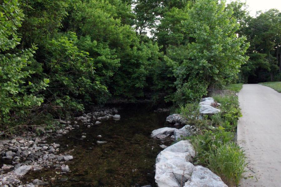
####MKT Trail
**Get on the trail at Fourth and Cherry streets, 501 S. Providence Road, 800 S. Stadium Blvd., 2701 Forum Blvd. and 3662 Scott Blvd.**
MKT Trail is 8.9 miles long, and it’s a great choice for MU students because it’s so close to campus. The trail is easy to navigate and, depending on where you enter, can be a long or short walk. It’s covered by an even layer of gravel, and the trail is cloaked by trees. Every once in a while, the trees open to reveal ponds, marshes or small rivers, and it’s a great scenic walk. The historic trail connects to the Katy Trail and was built on the old MKT railroad as part of the rails-to-trails movement in the 1970s. MKT stands for Missouri-Kansas-Texas, but no one calls it that. It’s a good trail to walk and talk with your friends. Bring a picnic; make a day of it.
####Eagle Bluffs Conservation Area
**Find the trail at 6700 W. Route K**
This trail is 3.2 miles long and offers picturesque views of Missouri’s wetlands. You can also see the Missouri River and Perche Creek as you walk the flat trail, but if you’re looking for something harder, you can climb up to the blufftop observation deck. It looks over the marshlands and is a great view, but it’s definitely a strenuous task to climb up to the top. If you’re looking to keep your day of trails simple, you can walk the gravel trail and see all the wetland ponds. The trail is open from 4 a.m. to 10 p.m. and is known specially for all the species of birds that you can see while walking.
####Hinkson Creek Trail
**Get walking at 2011 S. Old 63, 1600 Capen Park Drive as well as some access points at MU**
The Hinkson Creek Trail is a pretty, tree-lined trail that is close enough to campus to be walkable but far enough away that you still feel like you’re on a mini nature vacation. The trail connects Grindstone Nature Area and Capen Park and there are a bunch of great, photo-worthy bridges. It’s also an area you can take your dogs off the leash and let them run around. Capen Park is a trail that leads up to a rock-climbing paradise, and people who rock climb can bring their harnesses and do their thing. It’s a nice trail for everyone from the casual walker to the advanced rock climber.
####Three Creeks Conservation Area
**Find this trail 5 miles south of Columbia on Highway 63 and 1.75 miles west on Deer Park Road**
One of the longest trails on the list, Three Creeks is 11 miles of thick, forest-y goodness. This trail is a little harder as it’s more narrow, but it also has more trees and variety of wildlife because it’s farther out of town. The trail is not as well-paved as some of the other CoMo trails, so be sure to wear some good shoes, but it’s definitely worth it. Turkey, Bass and Little Bonne Femme Creeks are in this area, so there is a ton of Missouri beauty to be seen. Because the trail is so long, it’s a wonderful option for people who want to spend the whole day exploring.
####Rock Bridge Memorial State Park
**Get your walk on at 5901 S. Highway 163**
This state park has multiple trails, including Devil’s Icebox, Sinkhole and Deer Run. Devil’s Icebox features a rugged boardwalk and upstream caves. The rock bridge, the namesake of the park, is formed by a 63-foot high natural tunnel. The trail is half a mile, but it’s a tough run that’s a good workout and a cool place to explore. Sinkhole Trail offers a 1.25-mile walk that lets you look at big, gated sinkholes as well as trees and two concrete silos. Deer Run is a hilly trail that has a lot of deer along the path, as well as beavers and muskrats. It also features part of Little Bonne Femme Creek to add to the grassy scenic route.
####Bonus: The Pinnacles Youth Park
**Hike your heart out 12 miles north of Columbia on Highway 63**
This trail is more for hikers because it’s for people who know how to navigate hard terrains. The Pinnacles are rocky bluffs 75 feet high, 2 miles long that boast limestone arches and a great picturesque landscape. You can hike next to the bluffs or climb up them and see CoMo from a different lens. The terrain is pretty jagged and steep, but the view is definitely worth it.